
XCmap.aiAI Travel Co-Pilot for Outdoor Nomads
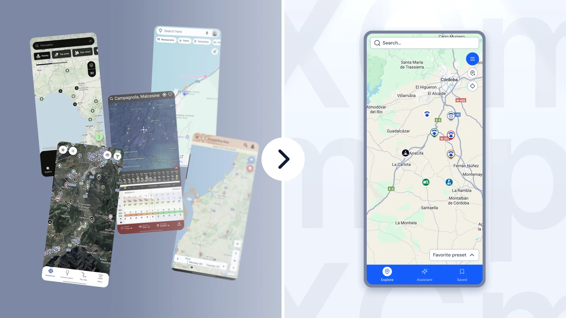
XCmap.ai helps motorhome and van travelers — especially those who also paraglide — plan stops, check conditions, and choose where to stay or take off, in one interface.
It also works for hikers, surfers, kiters, and anyone who mainly needs clear weather and location context — not only full-time road life.
Overview
- Role
- UX/UI Designer — visual product design, screens & interactions
- Timeline
- Nov 2025 - May 2026
- Collaboration
- 2-person team with product founder (scope & flow direction)
- Tools
- Figma · Nuxt UI · tight timeline · safety-sensitive domain
Stakes
The challenge
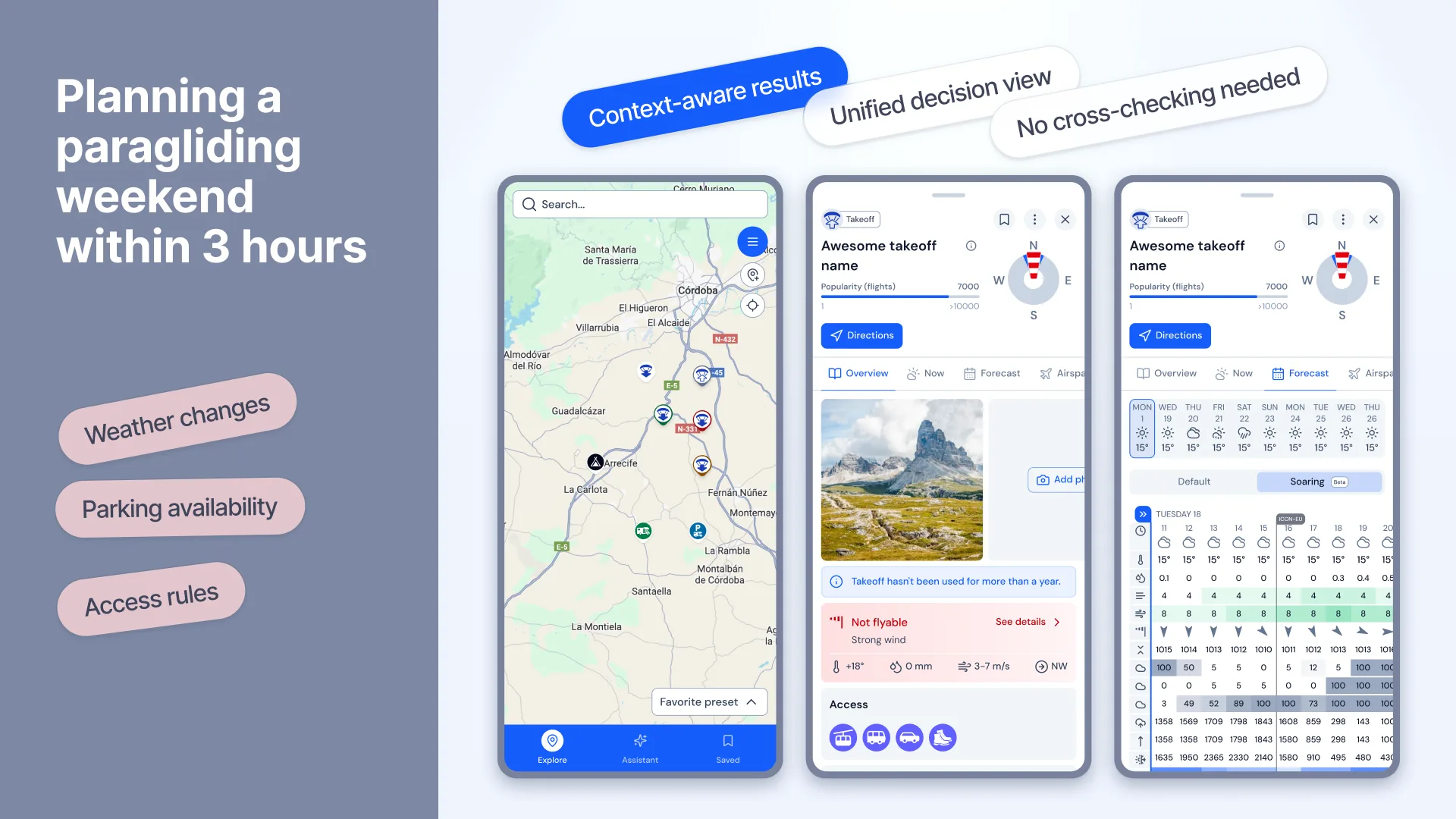
Primary persona: a full-time motorhome traveler who also flies paragliders. A familiar Friday question: “Where can we drive within ~2 hours, sleep safely, and hopefully take off this weekend if the weather allows?”
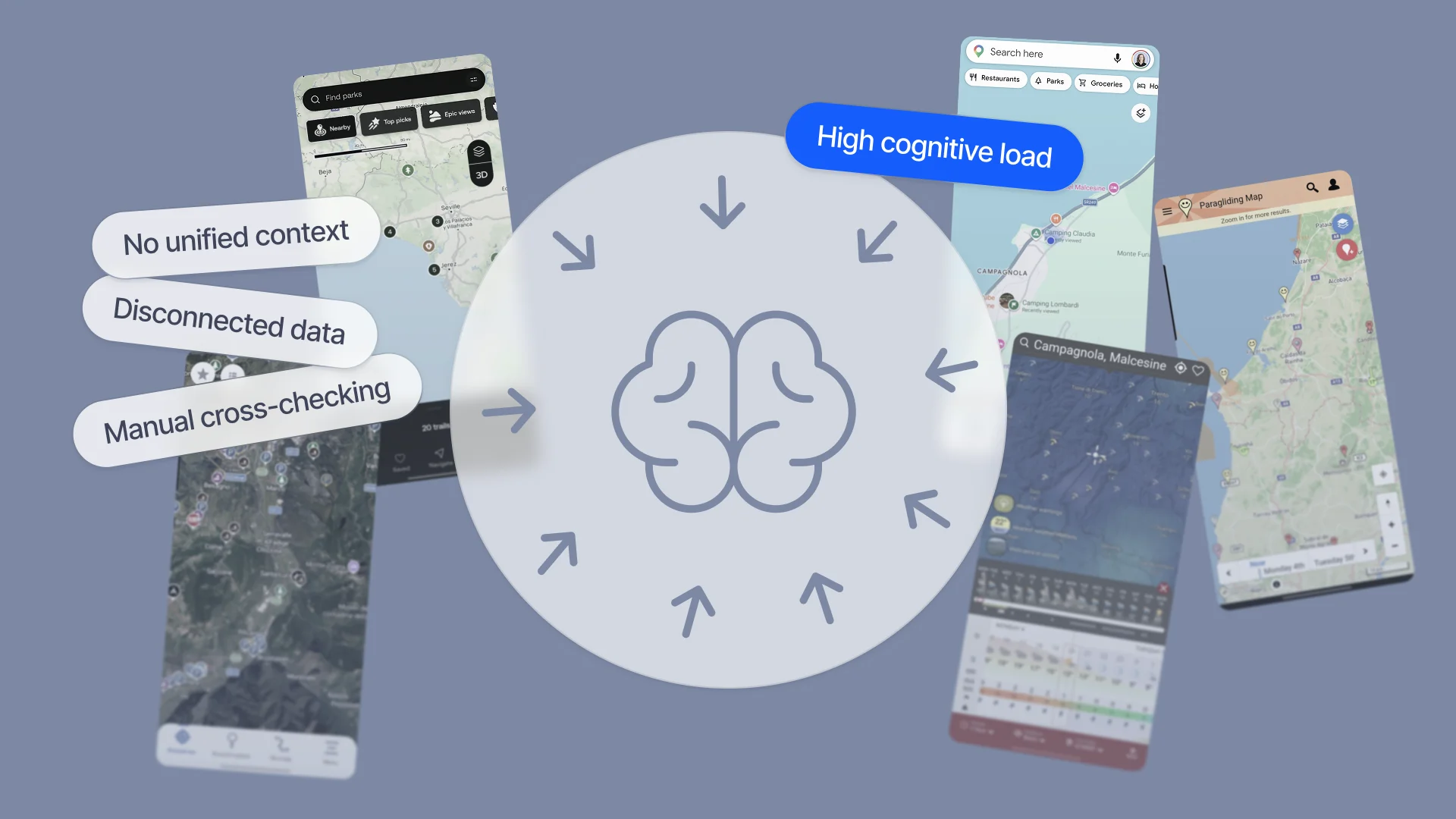
Answering that meant jumping between roughly five apps — maps, weather, camping/parking, community tips — then stitching the decision together by hand.
- no connection between conditions and logistics
- uncertainty about safety, legality, and access
- high cognitive load when comparing options
Planning became slow and fragmented — not because information was missing, but because guidance was.
Insight
What we learned
Research came from lived experience and the community around us: we live in a motorhome full-time and paraglide, spoke with other travelers and pilots, and tore down the apps we already used daily.
Formal usability testing with external users is next — now that the product is live.
- Maps provide information but not guidance
- Context (weather, access, timing) decides whether a place is useful
- People need a decision aid, not another dense information browser
So what: design for comparison and confidence — not for showing more data.
Solution
The solution
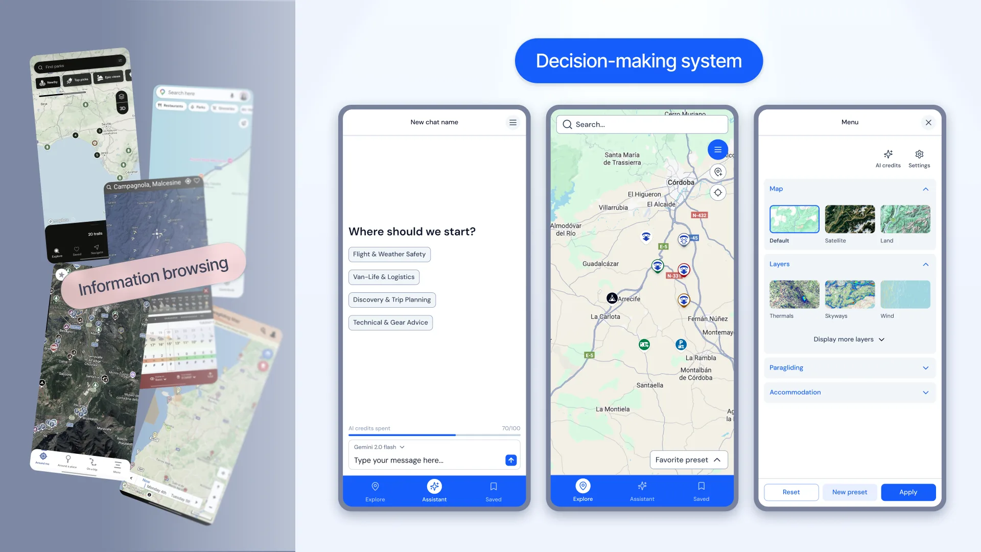
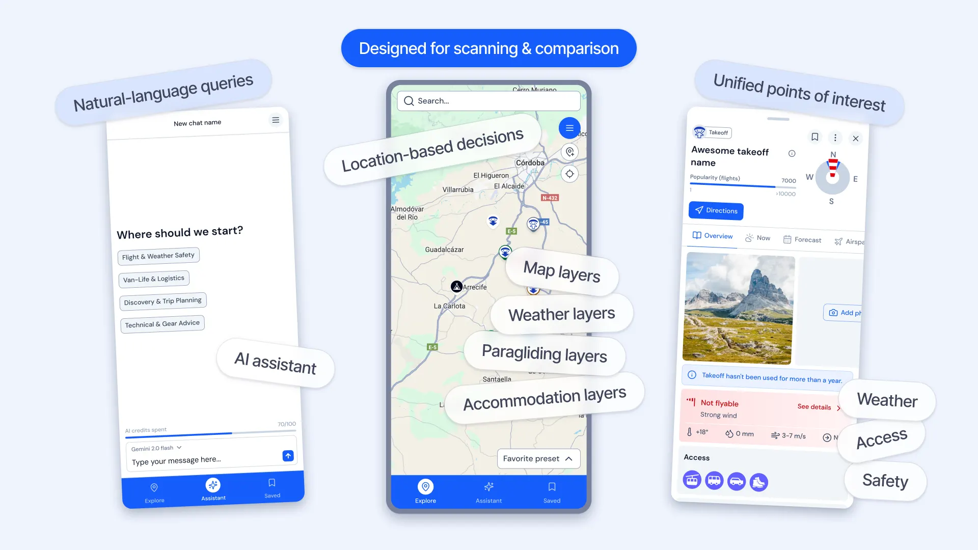
XCmap is a map-first decision system: compare options, check conditions, and act quickly when the situation changes.
Built around three linked layers — map, context, and AI — with unified POIs for parking, services, activities, and takeoffs.
- Map-first — every decision stays anchored in place
- Context over raw data — weather, access, and timing make a pin meaningful
- Clarity over feature depth — fast answers beat endless exploration
- AI as guide — suggests and narrows; the person still chooses
Solution
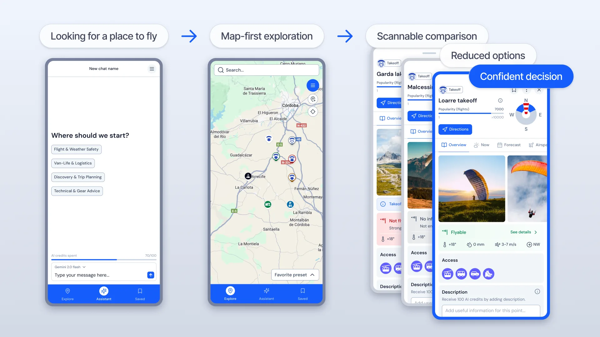
A real decision flow
Example: a motorhome-based paraglider asks for spots within a 2-hour drive where weekend weather looks workable for takeoff.
- AI returns possible locations in plain language
- The map updates with those pins so weather can be checked in place
- Each place opens into details, photos, videos, and reviews
- The user picks a stop — or asks a follow-up
Important product rule: AI never becomes a black box. Suggestions stay tied to visible map context and comparable options.
Craft
Design craft
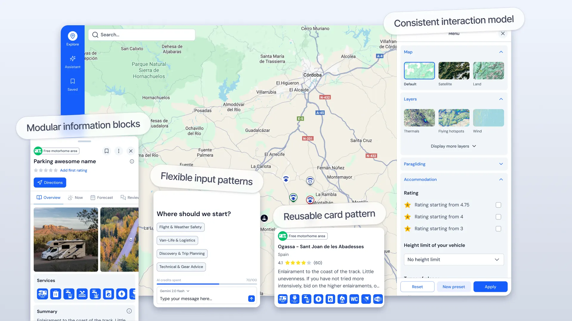
Dense outdoor decisions need calm UI: strong hierarchy, high contrast, minimal color, and progressive disclosure instead of showing everything at once.
I built a reusable Nuxt UI system — cards, panels, filters, inputs — so screens stayed consistent under timeline and library constraints.
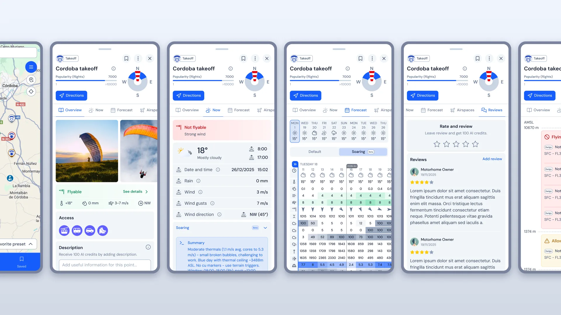
- Modular POI cards for side-by-side comparison without leaving the map
- Selecting a POI updates map and details together
- Filters and AI suggestions stay tied to the same visible context
Proof
Outcome
XCmap is live and ready for structured user testing.
- Shipped: map-first product flow, POI/filter/AI patterns, reusable Nuxt UI system
- Improved: an ~5-app planning stack collapsed into one place
- Improved: faster comparison and more confident decisions when weather, access, and logistics all matter
Proof
Reflection
In complex environments, people don’t need more information — they need help comparing options and acting with confidence.
The hardest tradeoff was clarity over feature depth. Progressive disclosure won — especially under Nuxt UI and timeline pressure.
Next: validate key flows with users beyond our own community, and refine AI from real usage — not assumptions.